
 The storm from Invest 99L is slowly moving away from a damp U.S. Virgin Islands and Puerto Rico and continuing its westward path, but another system, Tropical Storm Gaston, is still following on its heels.
The storm is a broad area of low pressure centered, as of 8 p.m. Wednesday, about 100 miles north of Puerto Rico, the National Hurricane Center reported. It produced gale-force winds over water to the north of the Lesser Antilles, with wind gusting over 45 mph. Satellite images indicated shower activity has become less organized than earlier in the day, and the low continues to lack a well-defined center.
As it passes west by Hispaniola and the Bahamas, conditions become more conducive for development and the system could still become a tropical cyclone during the next couple of days, the hurricane center said. The National Hurricane Center gave it an 80 percent chance of developing into a larger storm within the next five days and urged residents of the Bahamas and Florida to monitor it.
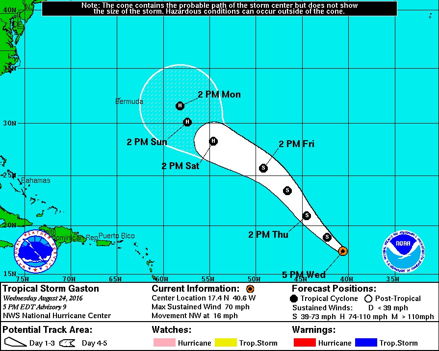
Tropical Storm Gaston continues to build as it moves across the Atlantic but most models show it veering to the northwest and giving the Caribbean a miss.
At 8 p.m. Wednesday, Gaston was about 1,100 miles west of the Cabo Verde Islands, with an 80 percent chance of developing. Tropical Storm Gaston could reach hurricane strength in the next 24 hours, the center said, but the storm could move into environmental conditions that might weaken it temporarily.
The current forecast shows the storm pushing through these conditions in roughly 72 hours and restrengthening, perhaps significantly.