
Gusty winds and hazardous seas are expected to continue across the U.S. Virgin Islands and Puerto Rico over the coming days, the National Weather Service in San Juan reported, with elevated rip current risks, hazardous marine conditions, and periods of passing showers.
Windy Conditions
Both U.S. territories have endured windy weather over the past few days, and according to the NWS, winds will remain elevated, particularly across exposed coastal locations and higher elevations. Wednesday is expected to be the gustiest day of the current forecast.
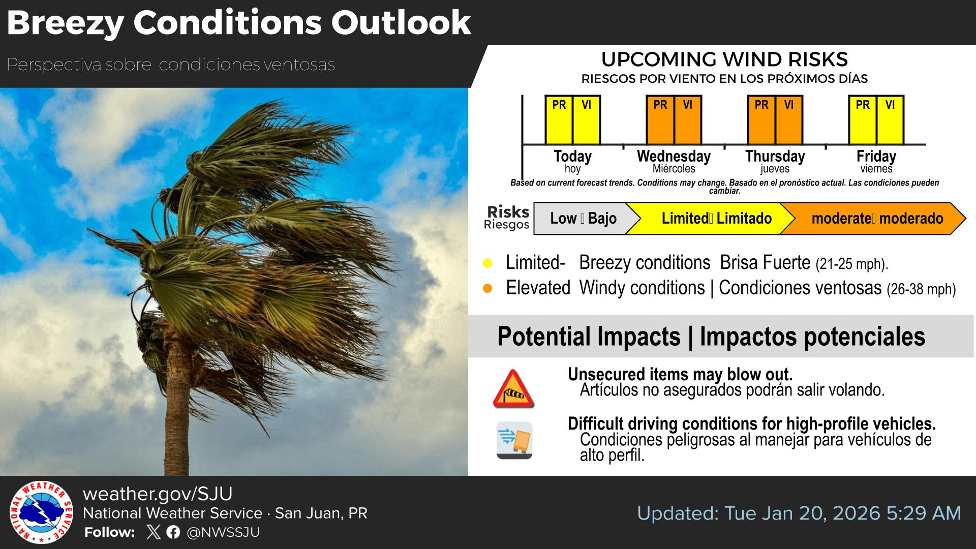
“A broad surface high pressure over the central Atlantic continues to strengthen, promoting breezy to windy conditions across the Caribbean basin,” the NWS stated. “These conditions are likely to deteriorate on Wednesday, with winds likely between 25 and 30 mph and gusts up to 35 mph, affecting the U.S. Virgin Islands and exposed coastal areas of Puerto Rico. Residents and visitors are encouraged to secure loose items that may blow around and report wind-related damage, if any,” the NWS added.
Hazardous Marine Conditions
Marine conditions are expected to remain hazardous, with gusty winds contributing to rough seas across the local waters. The NWS noted that several marine alerts are in effect across the region, including a Small Craft Advisory and a High Rip Current Risk. Additional marine warnings could be issued if seas or winds increase further.
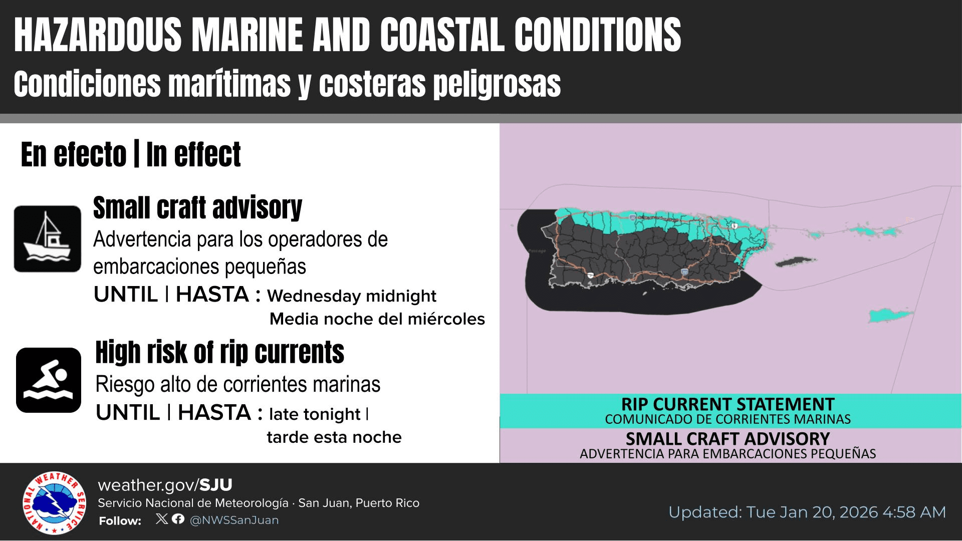
“Wind-driven seas are forecast for the rest of the workweek, resulting in choppy to hazardous marine conditions for small craft operators,” the NWS warned. “Therefore, several Small Craft Advisories remain in effect for most of the local exposed and offshore waters for the Atlantic and Caribbean, including the local passages,” the NWS continued.
Beachgoers are encouraged to remain cautious, as an elevated to high risk of rip currents is also expected to continue, especially along north- and east-facing beaches and other exposed coastlines across the local islands.
Precipitation is Possible
While widespread rainfall and flooding are not expected, the NWS noted that periods of passing showers and thunderstorms may develop under the current weather pattern. The NWS explained that residents and visitors across the region may experience inclement weather before drier air arrives later this weekend.
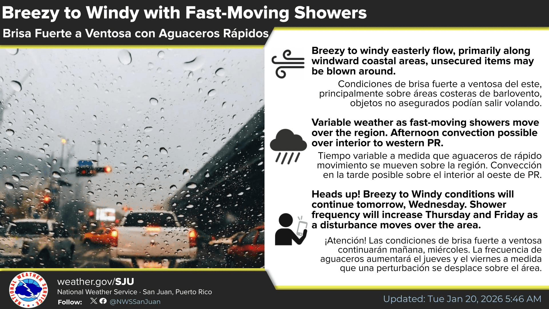
“A surface trough of low pressure moving westward across the region from Wednesday into Friday will lead to a gradual deterioration in weather conditions, increasing the potential for showers and isolated thunderstorms,” the NWS reported.
“Trade wind-driven showers will persist, moving from time to time and producing slippery road conditions and ponding of water in low-lying and poor drainage areas through this evening,” the NWS emphasized.
“Weather conditions will improve by late Saturday into Sunday as the disturbance moves out of the region and a drier air mass filters into the local islands.”
Watching the Local Weather
Local weather information, including marine weather conditions, is available from the NWS, the NHC, and the National Oceanic and Atmospheric Administration.
Additionally, the local weather forecast for the U.S. Virgin Islands is regularly updated on the Source Weather Page and the VI Source YouTube Channel. Residents and visitors can find additional weather alerts and preparedness information from the Virgin Islands Territorial Emergency Management Agency.
Finally, travelers are advised to monitor travel plans, as winter storm systems affecting parts of the U.S. mainland could result in flight delays or disruptions, according to NOAA’s Weather Prediction Center.


