
A study of seven watersheds of critical concern in the U.S. Virgin Islands has added another to its list after lobbying by residents of the North Side of St. Thomas, who asked that the Dorothea watershed, which includes Hull Bay, be incorporated into the project.

Funded by a grant secured by the Department of Planning and Natural Resources from the Federal Emergency Management Agency, the project is a team effort by a host of agencies and organizations, including DPNR’s Division of Coastal Zone Management and the Virgin Islands Conservation Society, with Vermont-based Watershed Consulting as the lead contractor.
The purpose is to create a sustainable development plan for the territory’s watersheds and implement fixes to mitigate problems now, such as flooding and toxic runoff that make beaches unsafe for swimming, especially after heavy rains, and harm the environment, both land and sea.
Watersheds under study since April 2021 on St. Thomas are Cyril E. King Airport, St. Thomas Harbor, and Bolongo Bay, which were chosen by DPNR based on their vulnerability to flooding and runoff, said Andres Torizzo, a principal and hydrologist with Watershed Consulting. On St. Croix, the focus is on the Long Point Bay, Diamond, Bethlehem, Hovensa and Salt River Bay watersheds.

At a virtual community meeting Wednesday evening with Torizzo, Marlon Hibbert, director of DPNR’s Coastal Zone Management division, said the Dorothea watershed has now been added to the study.
“While we were doing those plans [for the other watersheds] we heard from residents of the North Side community of St. Thomas that we needed to do a watershed management plan for Hull Bay,” which is inside the Dorothea watershed, said Hibbert. Officials were subsequently able to reprogram the existing grant to include the area for study, he said, and work is already underway.
“We’re happy that we’re able to be doing so. We’re excited for the community to be fully involved in the process. Today is just the kickoff. We do look forward as a department to working with the community to ensure that we have a fully involved process — a plan that reflects community concerns, that reflects community input, from the start to the finish,” said Hibbert.
“We’ve done a good amount … of foundation work and had an amazing turnout already just from different people in the community giving us input. It really is the time that we really do want to hear from people that live in the watershed,” said Torizzo. “It’s really the most helpful thing to have that community input — people that are on the ground and experiencing things in the watershed, rainfall events, it’s really good to have that perspective.”
In their natural state, watersheds — essentially a common area of land that channels rainfall and groundwater to a specific point, such as a gut, and out to the sea — sustain life, with 50 percent of rainfall soaking into the ground, 40 percent evaporating, and just 10 percent running into the ocean, according to Torizzo.
Development — businesses, parking lots, housing, and roads — threatens that balance by changing the landscape and creating excessive runoff that can devastate ocean life. Sediment and pollution, such as oil from roads and e-coli from animals and leaky septic systems, smother the sea floor, and also harm ecosystems on land such as the shrimp and crab species that reside in the guts, Torizzo said.
“Guts are designed by nature to handle a lot of water flow, so the need is to get the water flow back to the guts, and use them to convey the water to the ocean,” said Torizzo. “Not only is that a better way to get the water down the watershed, but the guts actually need that water to sustain the life that lives in the guts. We also want to reconnect the guts so we can restore the guts.”
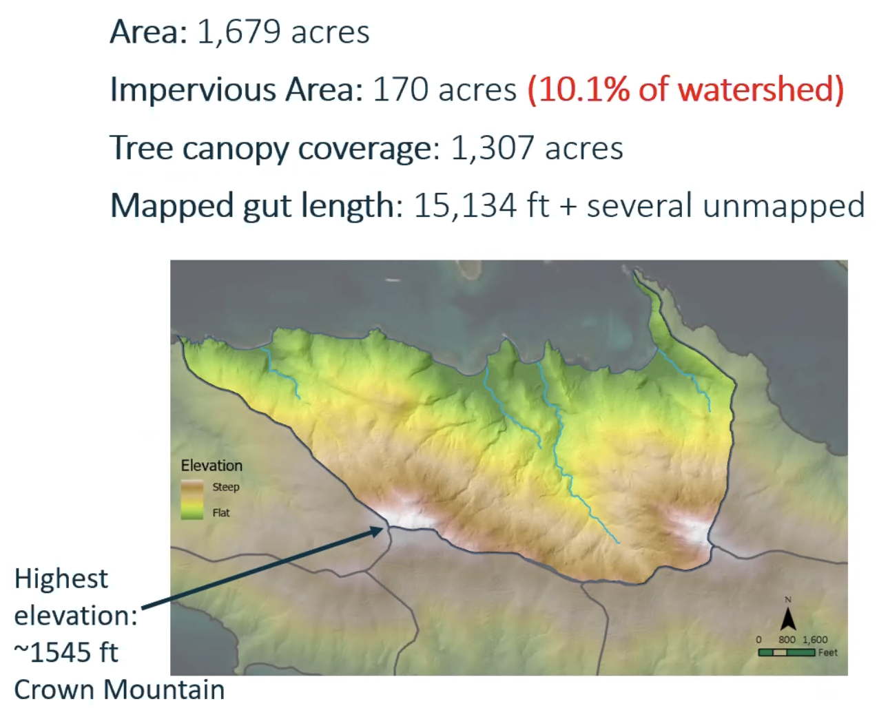
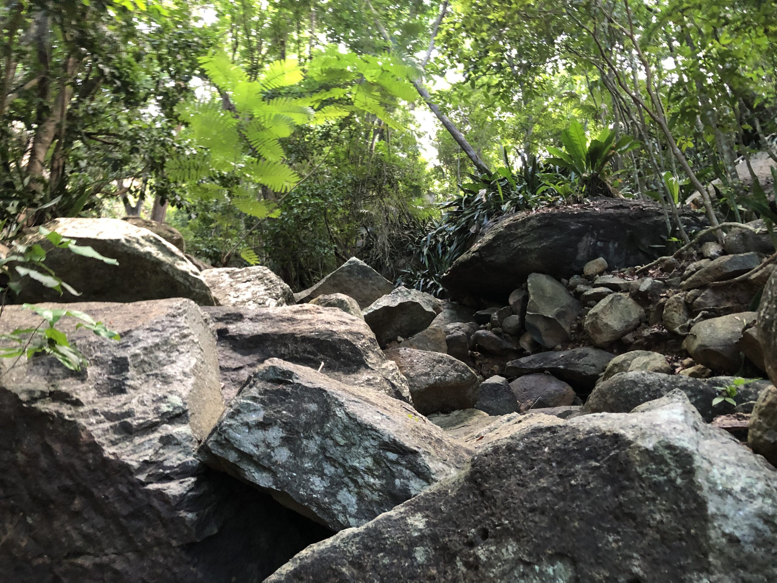
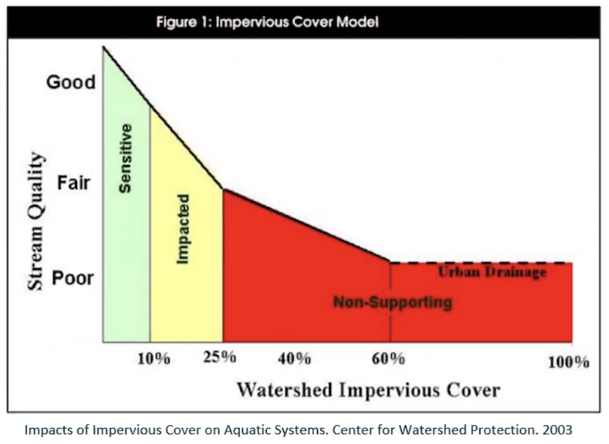
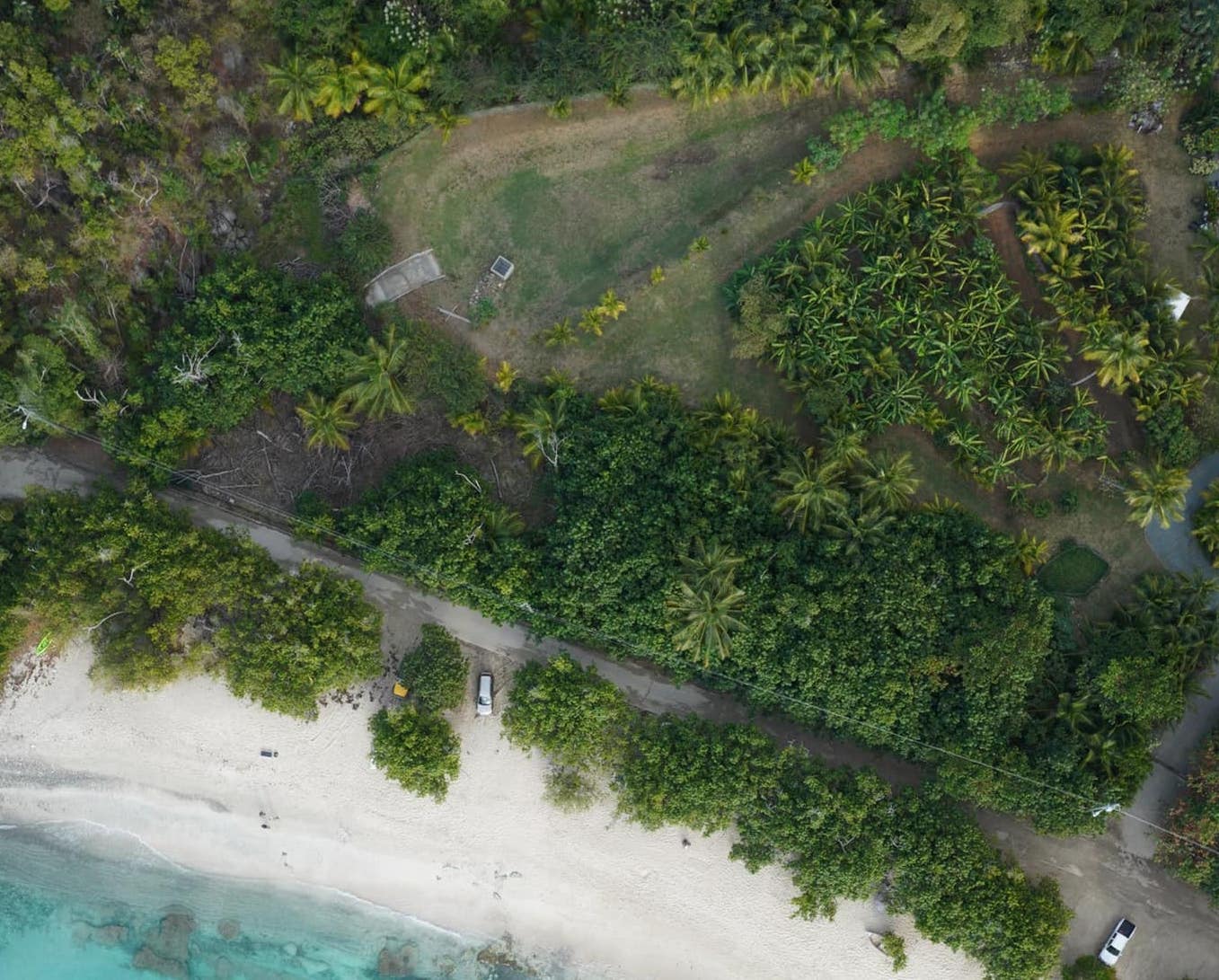
The good news is that the North Side of St. Thomas is less developed than the South Side of the island, and much of the watershed is still well preserved, with “really favorable stretches of undisturbed areas these guts flow through,” said Torizzo. At 1,679 acres in total and 15,134 feet in length, it contains several different gut areas that run from Crown Mountain into Dorothea, Hull Bay, Neltjeberg, and Caret Bay, he said. While not pristine, most are in “good condition,” and the impervious area is relatively low, at 170 acres, or 10.1 percent.
Still, there is much room for improvement, and a need to maintain good buffering into the future by targeting certain areas for land conservation to preserve the water quality, said Torizzo.
“Infrastructure is really important in this watershed — how the water gets conveyed down the mountain, by way of roadside ditches, paved swales, low-water crossings, culverts, guts, catch basins, pipes — all that conveys the water down to the outlet of the watershed. That’s really important,” said Torizzo.
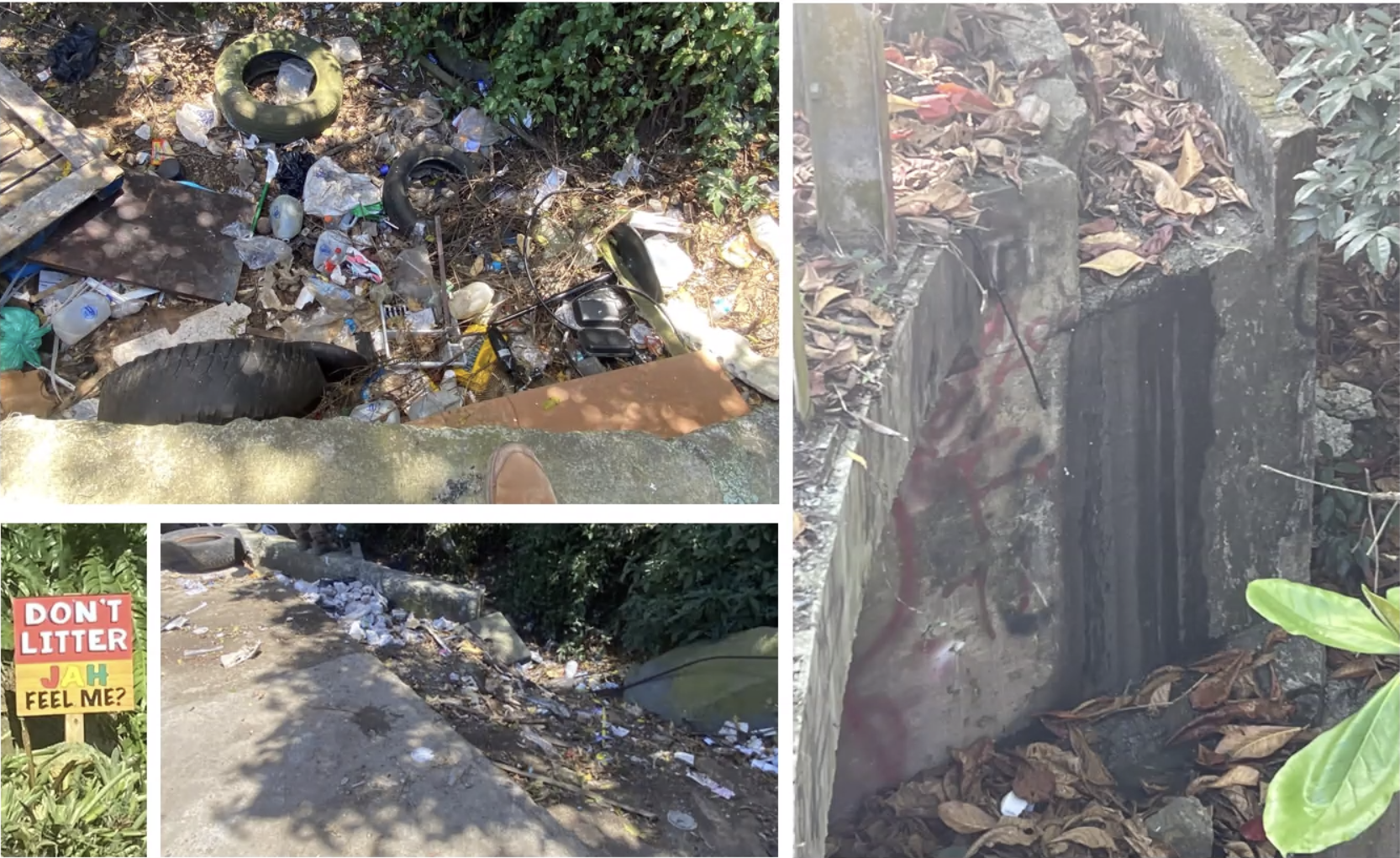
Poorly planned development, badly managed bin sites, illegal dumping, litter, clogged or broken culverts, erosion, unstable areas, and landslides from hurricanes Irma and Maria threaten the watershed, as do leaky septic systems, especially in the more developed residential areas above Hull Bay, said Torizzo.
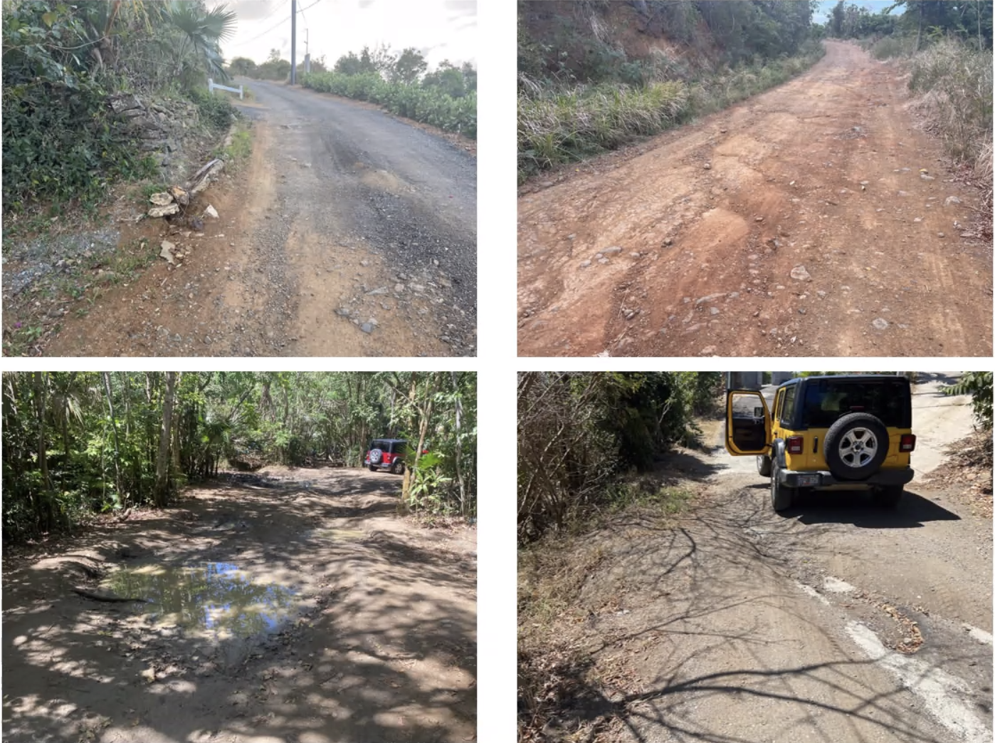
Also unique to the Dorothea watershed is the amount of dirt versus paved roads. While the latter are a problem because they are impervious — meaning they can’t absorb water — dirt roads, if not constructed properly, can be worse because they create heavy sediment and runoff during torrential rains, said Torizzo.
There are ways to help mitigate the problem now, however, including improving waste management, reporting dumping and illicit discharges to the DPNR, keeping drainage areas such as culverts, swales and guts free of debris, and adopting best management practices such as terraced walls and gardens and planting vegetation for erosion control.
“All of these are really opportunities. They are problems, but also opportunities,” to formulate an action plan to mitigate the damage now so the watershed is preserved into the future, he said.
“What we’re trying to do is just shine the light on the highest opportunities where we can make fixes cost-effectively to improve water quality. That’s really what we’re focused on doing with this plan,” said Torizzo.
The goal is to have such a plan in place by the end of the summer, once the field work is complete, said Torizzo. In the meantime, he is eager to hear from residents of the Dorothea watershed, especially concerning locations of flooding and water quality problems.
Email Torizzo at andres@watershedca.com. For more information and updates, visit the project website, and the Facebook page.


